Story highlights
Two people have died in series of earthquakes
Small tsunami hits country's eastern coast, although warning has since been lifted
A series of powerful earthquakes jolted New Zealand’s South Island Monday, triggering a tsunami and sending aftershocks across the country that left at least two dead, officials said.
The first event, a 7.8-magnitude quake, struck just after midnight Monday near the coastal community of Kaikoura, some 93 kilometers (55 miles) northeast of the city of Christchurch, the US Geological Survey reported.
It triggered waves of 2.49 meters (8 feet) above usual tide levels, the highest he has seen in his 38 years in New Zealand, Philip Duncan of Weather Watch New Zealand said.
An initial tsunami warning was lifted but temblors continued Monday afternoon. A 6.2-magnitude quake struck around 1:30 p.m. 39 kilometers west-southwest of Kaikoura, further north of Christchurch.
Prime Minister John Key posted a short video to YouTube after surveying the damage.
“It’s hard to see how those roads, neither north nor south, will be opened very easily,” he said.
“In the short term what we’re trying to do is make sure that the people of Kaikoura and the likes have food, water, help and backup.
“I’d say it’s billions of dollars worth of money that we have to spend here but we’re focused on what we’re doing and we’ll keep up the good work.”
Aftershocks
At least 42 seismic events have been recorded in the area in the last day, according to the United States Geological Survey (USGS).
New Zealand is a South Pacific nation of islands, the two largest being the North and South islands, which are home to most of the population. Aftershocks from South Island reverberated all the way to Wellington, the country’s capital on the North Island, where residents were told to stay indoors Monday.

The New Zealand Defense Force posted aerial images of a huge landslide in the northern part of the South Island, which blocked the road from Christchurch to Kaikoura.
“It is clear from the photos taken by our personnel that the major route from Christchurch to Kaikoura is impassable, Air Commodore Darryn Webb, Acting Commander Joint Forces New Zealand, said.
“So is the road from Kaikoura to Hanmer Springs and the one from Blenheim to Kaikoura,”
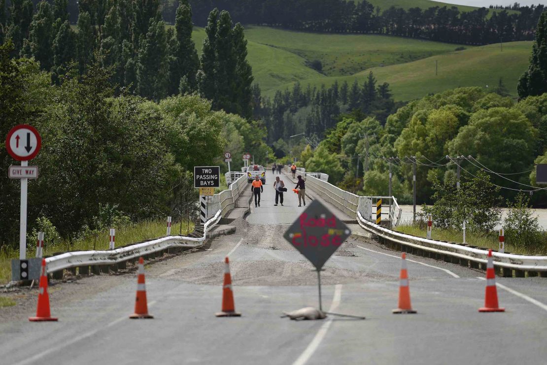
The Marlborough government emergency services Twitter account tweeted around 4 p.m. (11.00 p.m. ET), that a dam on the Clarence River had breached and a “large wall of water” was “heading downstream.” Authorities urged residents to seek higher ground.
The regional government also confirmed that a group of kayakers who had previously been feared lost on the river was found and evacuated.
“Other groups are understood to be in the area, a well-known whitewater rafting location, however it is understood they are well above the danger area,” a media release states.
‘It’s going to be a long night’
In Christchurch, memories of a devastating 6.3-magnitude earthquake in 2011 are still fresh for many. That quake killed 185 people and injured thousands, and reduced swaths of the city’s historic area to rubble.
“The land has been very peaceful for many, many months. So this is bringing back all the rare memories,” said Chet Wah, owner of Designer Cottage B&B in Christchurch.
“I just checked with all the guests. They are alright. It is scary. It’s going to be a long night.”
Christchurch, on the South Island’s eastern coast, has a population of more than 340,000 people, the most recent census shows.
Residents speak of moment quake hit

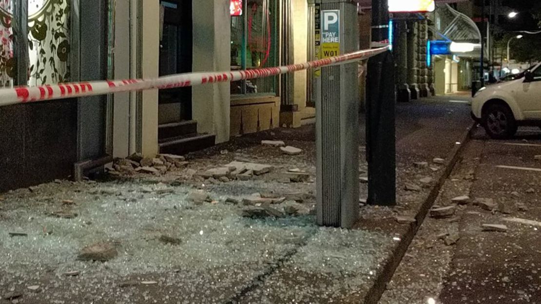
Images on social media showed shattered windows, toppled grocery items on the floor of a supermarket and water sloshing back and forth in swimming pools from different parts of the country.
Mark A’Court, owner of the Fresh Choice in Nelson City, posted security video footage on Facebook showing wine bottles falling from shelves at his store.
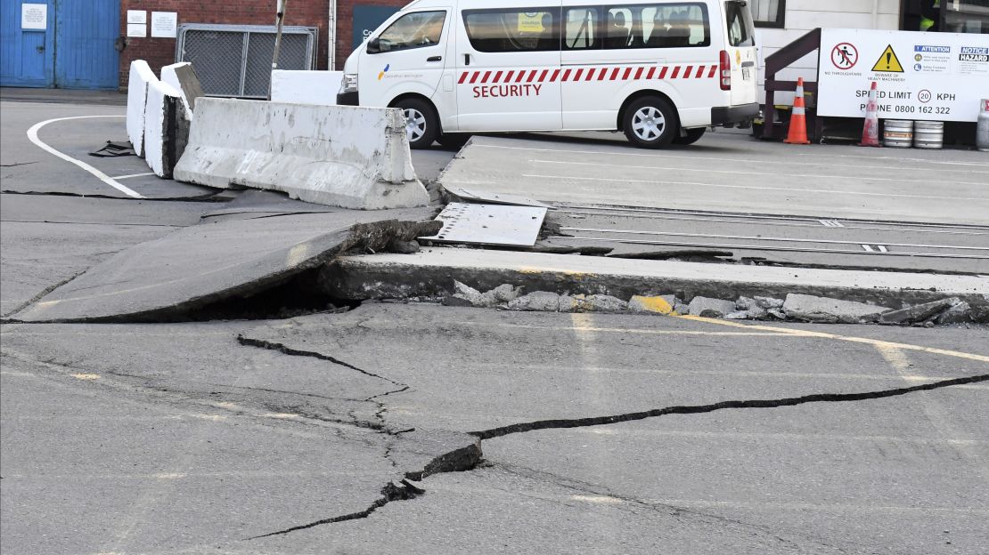
A photo of a road with a deep, wide crack down its middle served as sobering evidence of the temblor’s force.
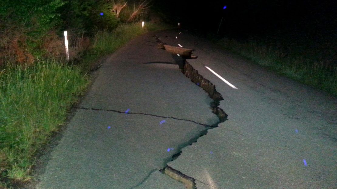
“This is the strongest [earthquake] I’ve ever felt,” Tamara Hunt said. She was with her husband at their home in Whanganui when the earthquake struck.
“It started off so small, like the cat moving in the bed, but then it started building and I had to run to the door. Stuff in the house was falling over and the doors were swaying really bad,” she said. “Then we decided to get out, and that’s when we saw our pool had lost a lot of water. The earthquake went on for two minutes.”
The South Island has been hit by a flurry of aftershocks, according to the USGS and New Zealand’s Geonet service, some with a magnitude above 6.0. Officials from the island’s second-largest town, Dunedin, called a state of emergency there.
Life in a ‘collision zone’

The USGS initially reported the quake’s magnitude at 7.4 at a depth of just 10 kilometers – shallow enough to cause serious destruction to the immediate surrounding area. It later revised the quake strength to 7.8, but changed its depth to 23 kilometers (14.2 miles), giving more of a buffer between the epicenter and the Earth’s surface.
New Zealand is regularly hit by earthquakes, because it sits in a “collision zone” between the Indo-Australian and Pacific tectonic plates. It is part of the Pacific’s “Ring of Fire,” a horseshoe-shaped belt around the ocean’s edges where many earthquakes and volcano eruptions occur.
CNN’s Samantha Beech, Sarah Faidell, Aliza Kassim and Brandon Griggs contributed to this report.


