


Tropical Storm Barry, the first tropical system to potentially make landfall in the US this year,is unleashing its first bands of wind and rain on the Louisiana coast.
Here’s what you should know:
How strong is the storm and where is it?

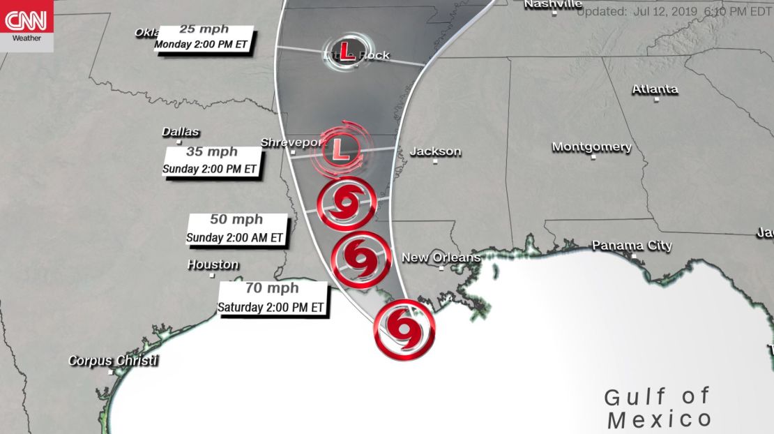
Barry was churningSaturday morning toward the Louisiana coastwith maximum sustained winds of 65 mph, per the National Hurricane Center said. It was about 165 miles west of the mouth of the Mississippi River and 55 miles south-southeast of Morgan City, Louisiana.
Barry is expected to grow into a hurricane by the time it makes landfall, the National Hurricane Center said. It’s likely to be a Category 1.
When and where will it make landfall?
After the wind and rain pick up across south Louisiana, landfall is expected early Saturday morning, somewhere along the state’s central coast.
The worst conditions for south Louisiana and New Orleans will kick in Saturday and last into Sunday.
Barry will then move inland to the Lower Mississippi Valleythrough Sunday, when it should begin to weaken, the hurricane center said.
What are the risks?
While wind is a huge threat in tropical systems, the dangers here are posed byheavy rainfall, storm surge and flooding, authorities have emphasized. And the worst conditions could be felt far from the center of the storm.
When it comes to rain, one of the most important factors will be the storm’s forward speed.
Barry was crawling at 5 mph Saturday morning. And the slower it moves, the more time it has to dump rain on the same places. The forward speed could mean the difference between 5 inches of rain and 20 inches.
It’s also important to look out forbands of thunderstorms. The worst weather during hurricanes is typically found closest to the eye of the storm, but that’s not necessarily the case with tropical storms that are still forming, like Barry.
In storms like this one, the worst conditions – the heaviest rain and the strongest winds – are in the strongest clusters of thunderstorms, which could pop up a hundred miles from storm’s center.
Storm surge will be a concern, peaking late Friday night through midday Saturday, then lessening after landfall. The surge, which could be felt anywhere near and east of where the storm makes landfall, will be maximized during high tide Saturday morning. Areas outside public levee systems are most at risk.