After a brief lull in activity, two new tropical systems are moving through the Atlantic, potentially adding to the record pace of the 2020 hurricane season.
Both systems are expected to develop into tropical depressions or storms later this week. Tropical storms Laura and Marco, the next names on the list for the year, would be the fastest 12th and 13th storms to form, smashing more records for most storms this early in the season.
Abnormally warm sea surface temperatures are helping provide fuel for the pace of tropical cyclone formations. An enhanced La Ni?a Watch was also issued, which could further strengthen hurricane activity.
We are still weeks away from peak of hurricane season
“What people need to realize is that we are still 23 days from the peak of hurricane season, and we are very much on a record pace,” CNN meteorologist Chad Myers said.
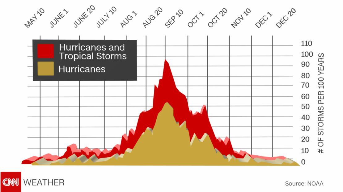
Hurricane season typically peaks around September 10, when waters in the Atlantic are close to their warmest. To have had so many named storms this far before the peak is unprecedented. What’s more concerning is that 85% of major hurricanes (Category 3 and above) occur after August 20. This is due to warmer ocean waters and less wind shear. Wind shear is the change of wind speed and direction at altitude, a phenomenon that tears storms apart.

Eleven tropical storms have already developed in the Atlantic this year, compared to the typical three by this date. Tropical storm Kyle formed and dissipated last weekend, the earliest the 11th storm has formed. Normally, it does not form until November, and there is no average date for the 12th storm since there typically isn’t more than 12 named storms in a season.
Development in Central Atlantic could soon become Tropical Storm Laura
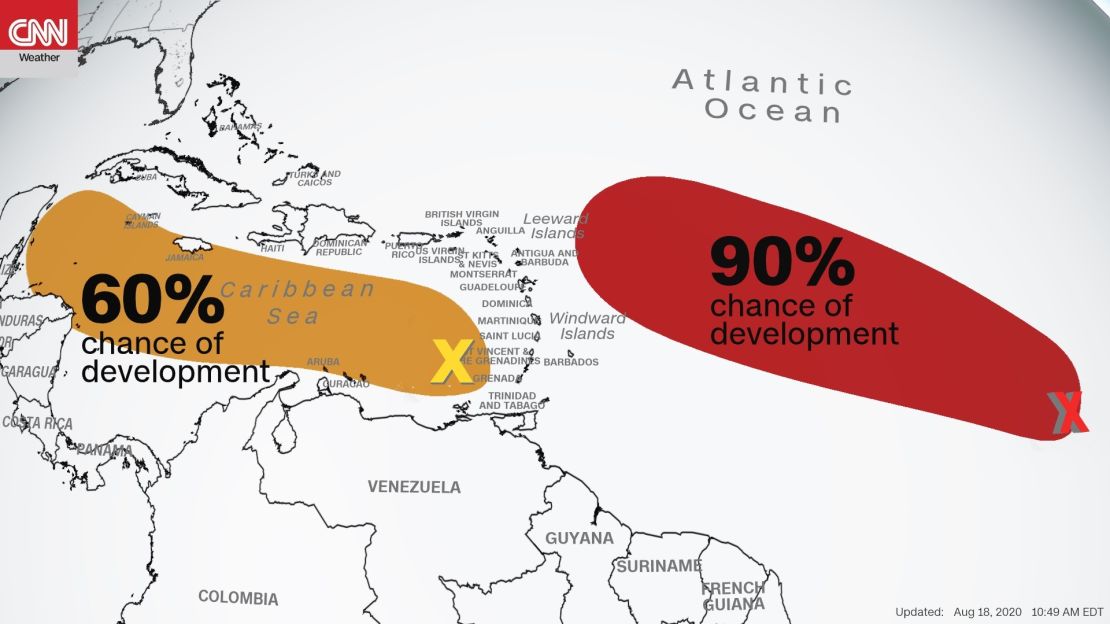
The disturbance most likely to develop into tropical storm Laura is located 900 miles west-southwest of the Cabo Verde Islands. It has a 70% chance of developing into a tropical depression or storm within the next 48 hours and a 90% chance of developing in the next five days, according to the National Hurricane Center Tuesday morning. If it does become Tropical Storm Laura, it would smash the record for the earliest 12th storm on record, previously set August 29, 1995.
“The most concerning spin right now is in the Central Atlantic moving west towards the Leeward Islands,” Myers said. “The models do have it getting stronger and approaching the islands Friday or Saturday. Longer term models try to take it in the Gulf of Mexico by Monday.”

The second disturbance, located north of Venezuela in the Caribbean sea, is not an immediate threat. However, as it moves to the west-northwest south of Cuba and towards the southern tip of Mexico, conditions will become much more favorable for its development. It has a 60% chance of developing into a tropical depression or storm in the next five days according to the National Hurricane Center.
Although it is too early to tell with certainty, both systems appear to be on track to impact the US mainland by next week and are being monitored closely by the National Hurricane Center.
