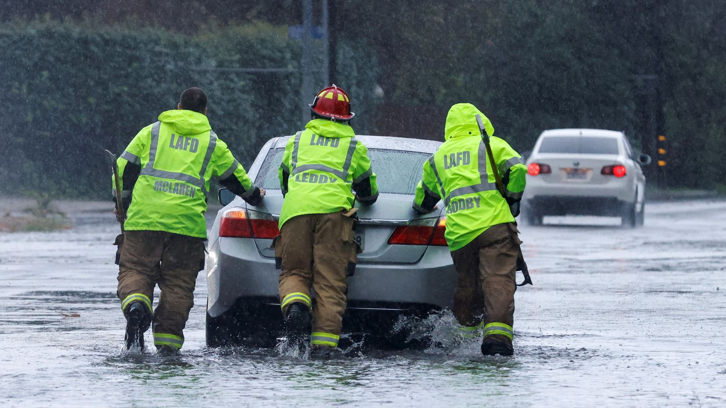
The first of two atmospheric rivers is unloading heavy snow at high elevations and gusty winds and soaking rainfall Thursday across a large part of California.
More than 20 million people are under flood alerts?as storms threaten flash flooding in cities including Los Angeles, San Diego, Sacramento, San Francisco, San Jose and Oakland.?The threat will last into Friday morning for central and Southern California.
Floodwaters began to rise as rain pounded parts of Southern California Thursday morning, forcing parts of the Pacific Coast Highway and the 710 Freeway to close and leading to a handful of water rescues.
Long Beach – south of downtown Los Angeles – bore the brunt of the dangerous flooding. Videos posted to social media showed some Long Beach roadways completely underwater. Vehicles splashed and made waves while driving through the high water. At least one car was submerged up to its windshield.
Fire crews had to rescue people from a few submerged vehicles from an area road, Long Beach Fire Capt. Jack Crabtree told CNN. No one was injured.
First responders in nearby Orange County rescued a man who became trapped in a storm channel after heavy rain turned it into a quickly flowing river Thursday. He was taken to a hospital in stable condition, fire officials said.
While there may be a brief respite after Thursday’s storm drenches Southern California, another atmospheric river – likely stronger –?is poised to move across the region beginning Sunday.
Rainy conditions are expected to continue well into February as a more typical?El Ni?o pattern?kicks into gear.
El Ni?o – a?natural phenomenon?in the tropical Pacific?that influences weather around the globe – causes changes in the jet stream that can point storms directly at California. Storms can also tap into an extra-potent supply of moisture from the tropics called an atmospheric river.
On Wednesday, the first of two atmospheric river storms slammed into Northern California.
Steady rainfall and periods of stronger winds from the storm will impact Southern California into at least early Friday. Much cooler air will also begin to overspread the state during this time.
Rainfall of 1 to 4 inches is possible in the southern part of the state, falling at rates that could exceed 1 inch per hour.
A Level 2 out of 4 risk of excessive rainfall is in place Thursday for Southern California. Roads and low-lying areas are at the most risk for flooding, and rises on some waterways are also possible.
Flood watches across central California will remain in effect through Thursday night. An additional inch of rain is possible across the region Thursday. The coastal ranges picked up 2 to 4 inches of rain through Wednesday night, while valley areas recorded 0.5 to 1.5 inches.
Meanwhile, the western half of California could see a few thunderstorms that may produce bursts of heavier rain. This would come after a?series of torrential thunderstorms wreaked havoc on?San Diego last week.
San Diego officials warned of potential evacuations in flood prone areas, including some that flooded last week.
“This warning is voluntary. It is designed to encourage residents in these flood-prone communities to prepare if, or when, an evacuation order does become necessary,” San Diego Mayor Todd Gloria said in a Tuesday news release.
Swift water personnel and equipment?are ready to respond?in 12?California?counties, with 400 personnel prepped across 16 counties,?the state?Office of Emergency Services?said.
“The state is working around the clock with our local partners to deploy life-saving equipment and resources statewide,”?Gov. Gavin Newsom said.
Snow is also a threat
Farther north, officials are also preparing to respond to a bout of wintery weather conditions.
More snow is expected to accumulate at lower elevations across parts of Northern California and the Sierra Nevada on Thursday as cooler temperatures move in. Up to 4 feet of snow could bury the highest peaks of the Sierras, with at least 6 inches of snow possible for some lower-elevation mountain roadways.
The snow is welcomed for California’s snowpack, which has been beleaguered by warmth and storms that have brought more rain than snow.?This winter’s snowpack?is just 52% of average for this time of year, according to the latest survey conducted Tuesday by the state’s Department of Water Resources. Snowpack is a vital water source, and the survey helps California to forecast how much water will be available for the remainder of the year.
‘Largest storm of the season’ to begin this weekend
Friday will bring showery weather that’s expected to linger over much of California as moisture slowly pushes out and across the Southwest.
Then on Sunday, another more potent atmospheric river-fueled storm is poised to lash Southern California. That could become the “largest storm of the season,” the National Weather Service in Los Angeles warned.
“It is very likely that this will be a serious 2 to 3 day storm system,” meteorologists there said.
While more details on this storm are still coming into focus, forecast models show a more widespread and prolonged?flood threat, especially for Southern California. At the very least, another few days of rain and snow are likely across the rest of the state.
The second storm could potentially stall over the region and unload several inches of rain from Sunday to about midweek.
Temperatures are also likely to start out much cooler with this storm than with the first storm, with more snow possible down to mountain pass levels or potentially even lower elevations.
CNN Meteorologist Robert Shackelford and CNN’s Cheri Mossburg and Joe Sutton contributed to this report.
